
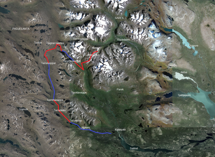
After an incredibly beautiful night up at the Luohttolahko plateau, it was time to leave the heart of Sarek. The plan was simple: I wanted to cross the small stream Luohttojahka, which appeared to be quite insignificant on the map, much further upstream than recommended in my guidebook. On a more direct line into the valley Njoatsosvagge I would be able to avoid losing too much altitude in between. So far, so good…

How hard can it be?!
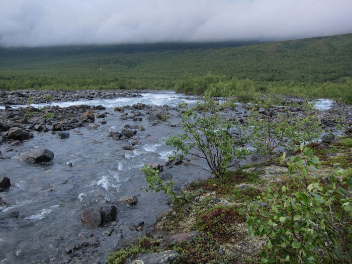
Already from further up, the stream didn’t look very encouraging. Fast-flowing in a small riverbed, nowhere becoming even a little bit wider. I started to doubt my plan. But I tried to motivate myself by thinking about the reward of this shortcut, and at least I wanted to have a try. How hard can it be?!, I remembered the start of my trip.
I decided to try my luck at a place without evident swirls. Wearing my crocs and the trekking poles, I entered the water. Already one meter from the shore it got
problematic. It was more of a torrent than a little stream, and the worst was the extremely bumpy riverbed. While the water had been knee-deep after the first step, with the next one already my
hip disappeared in the water. And this was only the first meter!


No chance! It was hardly possible to stand safely, let alone to move on. I managed to get back to the shore I was coming from. A good decision, but a disappointment nevertheless. And it got worse… The alternative was to follow the slope on this side of the stream further down, and the slope turned out to be especially nasty. It was completely covered with head-high bushes, which made it impossible to see the ground I was putting my steps on. Several times I couldn’t keep the balance and stumbled upon the roots of these monsters. And then it happened… Again I could only avoid falling by leaning on my trekking poles, but this time I was using too much force. The central segment of the pole could still handle an almost 90 degree angle, but then it broke.


That’s probably the drawback of a 3-segmented pole… However, this was still much better than a broken arm. Although two poles are definitely an advantage, especially when crossing deeper rivers, everything else shouldn’t be a big problem with only one of them. Wait, I still had to cross Luohttojahka stream, the reason why I ended up here…

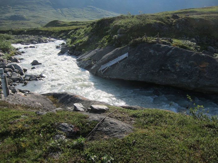
Somehow I got out of this, and the bushes got less and less widespread. Further down I passed a former bridge, which had been smashed into pieces years ago. Now I
would listen to the guidebook, that’s for sure. A little bit further, the stream divided into separate arms. Here it should be possible. It was not so easy to find a good spot to cross, since the
shores were covered by thick shrubs again. It was already quite late and I still had the plan to enter Njoatsosvagge valley that evening. However, if I would encounter problems again, I would
have to stay here for the night and make different plans for tomorrow.
The river was still quite strong here, but fortunately not much more than knee deep. Although I crossed four separate arms, three of them were still not easy. Finally, I was happy to reach the other side. But my bad luck still hadn’t finished. Suddenly, I lost one of my glasses. It simply fell out of the frame. Luckily, it didn’t split into pieces, and I managed to put it in again.

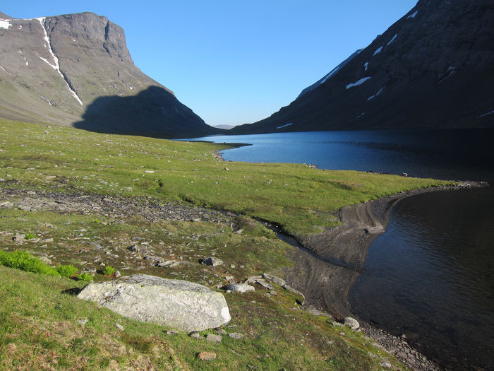
I had learned before that it’s most important to limit the losses on such a day. After a two and a half hour walk I managed to reach a wonderfully located campsite above the lake Lulep Njoatsosjavrre. To my surprise, there was even mobile coverage here. Not that I would rely on that on such a trip, but if you’re travelling alone it’s always nice to have the opportunity to send a message home from time to time. Finally, my bad day found a reasonable end.
Njoatsosvagge
The next day, I took it easy. Yesterday had been demanding, and it was necessary to slow down a little bit. The major difficulties had been passed, which gave me some time to enjoy the beautiful landscape in Njoatsosvagge valley, which is very narrow and surrounded by extremely steep mountains on both sides. There was even time for a bath in one of the three lakes along my way. The water was a little bit warmer than expected, maybe 12 degree. I got into the water quickly, but even quicker, I got out of it :)

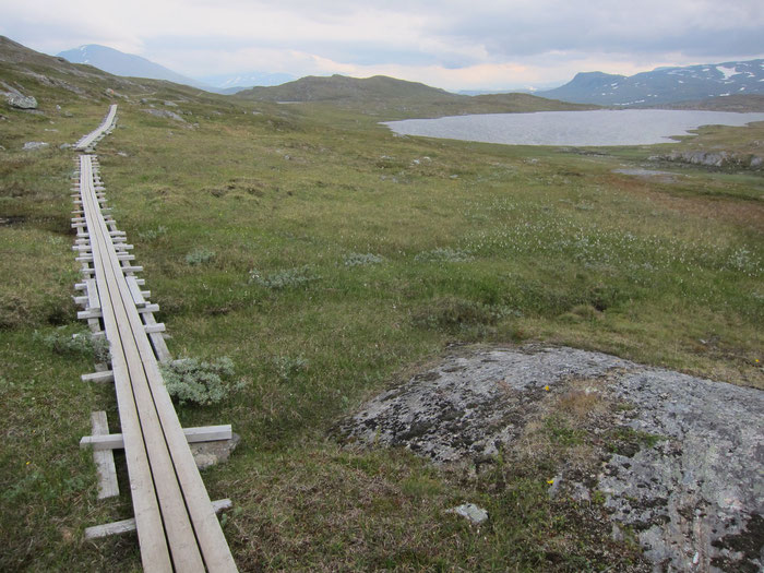
Padjelantaleden
After a little side-trip in the direction of the Tuottar lakes, I reached Padjelantaleden. This is a long-distance hiking trail through the Padjelanta National Park, the home of different Sami tribes and their reindeer herds, and Tarradalen. In contrast to Sarek, Padjelanta is more a kind of mountain plateau, but still hilly, and covered with countless smaller and bigger lakes.

Padjelantaleden is a marked trail with signs every few meters. There are also huts in a distance of roughly every 15 to 20 kilometers which make it possible to experience the Lapponian nature without a tent as well. I felt like on a “highway” and almost like back in civilization, although I didn’t meet anyone else in the beginning. The weather turned now. Strong winds and dark clouds instead of sunshine. I decided to stay in a hut at Tarraluoppal, where I had started my tour a week ago. It was surprising to be the only guest there that night. Rain came up during the next day. But it was a relatively easy walk on the often wood-covered trail to the next hut, Sammarlappastugan.
Suddenly, someone appeared out of the bushes in front of me. A really tall, quite old guy, carrying an enormous stick out of wood with him. “Hej!”, I greeted him. “Wuhuhuhuhhhh”, he responded, shaking his head like crazy. I got a little bit frightened. I let him go ahead and didn’t see him for a while. I already started believing in a hallucination, but there he showed up again. We reached the hut together, where he turned out to be speaking. As soon as Henrik from Sweden got some food at the hut, he recovered and started to talk about his life. He had been running out of energy because he couldn’t find any blueberry soup in the previous huts, he explained.

The flood
My holiday got a little bit more luxurious, since I decided to stay in a hut for another night. The now unsteady weather made this decision quite easy, and later it proved to be a good one. Sammarlappastugan was the place I became a member of STF, the Swedish Turistforeningen. But actually, the huts are not really that luxurious. Although blankets and bed linen are provided, I learned that you are expected to use your own sleeping bag nevertheless. The only upgrade to your own tent is a little softer mattress. On the other hand, you cannot avoid the mosquitoes in the hut. But hey, only 10 mosquitoes, not so bad, is it?
When I woke up the next morning, the rain was pouring down. It had been raining like that since midnight already. The level of the river next to the hut had been
rising considerably. In fact, the water was not far away from the hut itself anymore. The pilots of a stopping helicopter mentioned a prediction of 40 liters of rain for this day alone…

Other hikers had been arriving out of the rain: Fabian and Maxi, students from Germany, and Remko from the Netherlands. Together we were stuck in Sammarlappastugan
that morning. Fabian and Maxi made a first attempt to walk on, but they returned soon. Obviously, it was tricky to cross a small stream close to the hut. It was totally out of control, flowing
outside its riverbed through the bushes. If this one was already a problem, how would it be possible to ford a much bigger stream further down the way to the next hut, Tarrekaisestugan?!
Moreover, it was quite suspicious that absolutely no one had been arriving from the other direction so far. The situation was a little tense, we considered our possibilities: Having a try,
waiting for better weather or, as a last option, flying out by helicopter? And, after all, would the latter option still be possible?

The rain got less intense during the early afternoon. Later, it even stopped for a while. After another hour, I decided to start. The first stream was not as problematic as before anymore. After a while I met two groups of other people in the opposite direction, who reported the bad news: They had no chance to wade the bigger stream not far from Tarrekaisestugan, since the water had been deeper than their hips, around 100 meters wide and was even strong enough to move the stones in the riverbed… I believed them, and it was clear that these conditions would definitely make a crossing impossible.
Nevertheless, I still continued. I had to see it with my own eyes. Unfortunately, it was an approximately 9 kilometers walk before I would reach the critical place.
I still believed in a little chance, remembering what I had been learning during my studies in university. Such a small catchment area like the one of this stream usually results in a hardly
delayed runoff. In other words: The discharge will rise rapidly and reach its peak only shortly after the rain. My hope was that the water level would fall almost as quickly as it had been rising
before.
After three long hours on the largely water covered trail, I finally reached the crossing. It still looked difficult, but not as dangerous as described. The large
riverbed covered with big stones was not completely flooded anymore, and the stones were also not moving. However, the torrent still looked too dangerous to pass it. Further down the stream
divided into two separate arms, not very broad, but their depth was hard to judge. I searched for a place with a lower gradient. Here it could be done. Hopefully. In order to better control my
steps in the uneven riverbed I kept wearing my hiking boots.
Luckily, it was not too dangerous anymore and I managed to reach the other side. After a little while, also Fabian and Maxi arrived and crossed the river at the
same place. Exactly in that moment, the helicopter passed us and Remko could observe the scene directly from above. Now it was one more hour to Tarrekaisestugan. One hour in the dripping wet
boots. But nevertheless we were happy that we made it this way.
Excuse me, where's the disco?
The last day of the hike back to Kvikkjokk was a little bit of a hurry, since we had to reach the boat in the afternoon. That way we passed the Kvikkjokk delta and arrived at the STF fjell station. Our motivation after another day in wet shoes in the lower Tarradalen, which had more and more turned into a landscape dominated by dense evergreen forest, got less and less. But we kept telling ourselves the “rumors” we had heard (or we thought up) about Kvikkjokk, our final destination, would be true: There would be great food, for sure, no pasta anymore! And a sauna! Definitely! And a disco, party all night, could that be possible?!
When we arrived, we realized that they had quite good (and expensive) food, indeed. I was very happy to refill my energy reserves. A sauna? Yes, there was one!
Concerning the disco, we better cloak this in secrecy… But what we definitely had was some fun. It turned out that our roommate in the four-bed room was actually Remko. I will never forget his
story about someone’s creative way of using a ‘multi-purpose cup’ while being trapped in a tent during heavy rain.


There are no comments yet.